By clicking on this link you will be leaving the Erin Ventures website and entering the website of a third party. Erin Ventures has no control over this third party website and accepts no responsibility for either its content or its security. Erin Ventures does not adopt, confirm or endorse any information that may be contained on this website.
External links either open a new browser window or prompt you to view or save a PDF file on your computer. Click [X] to close these new windows to return to this page on the EV site.
(or press ESC or click outside this window)
This release contains forward looking statements. The words "believe," "expect," "feel," "plan," "anticipate," "project," "could," "should" and other similar expressions generally identify forward-looking statements. Readers are cautioned not to place undue reliance on these forward-looking statements. These forward-looking statements are subject to a number of risks and uncertainties including, without limitation, variations in estimated costs, the failure to discover or recover economic grades of minerals, and the inability to raise the funds necessary, changes in external market factors including commodity prices, and other risks and uncertainties. Actual results could differ materially from the results referred to in the forward-looking statements.
(or press ESC or click outside this window)
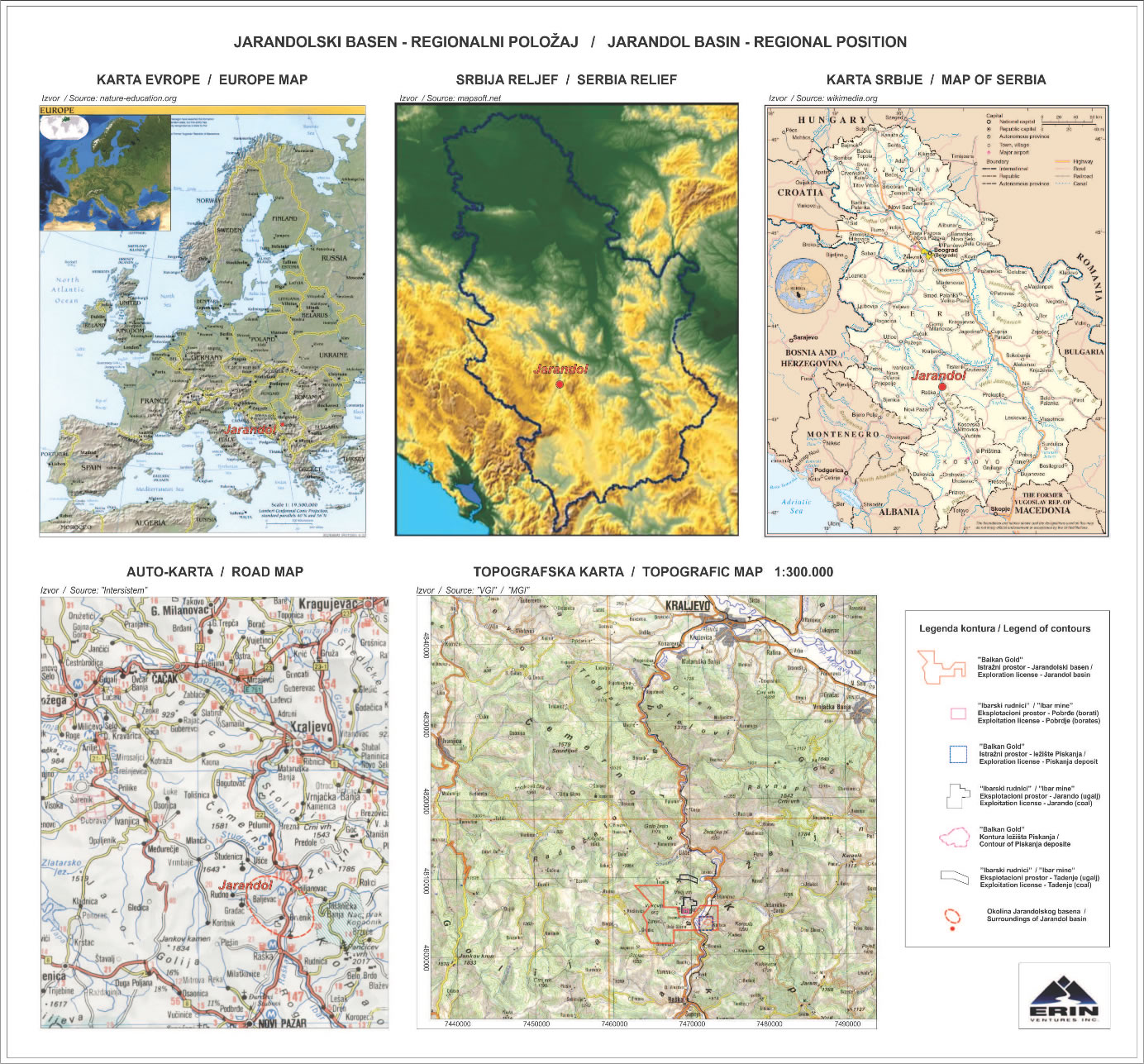
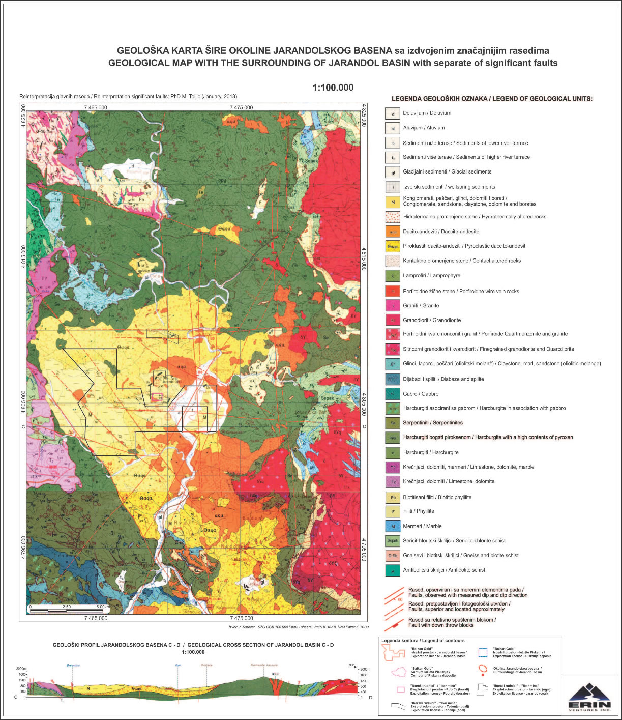
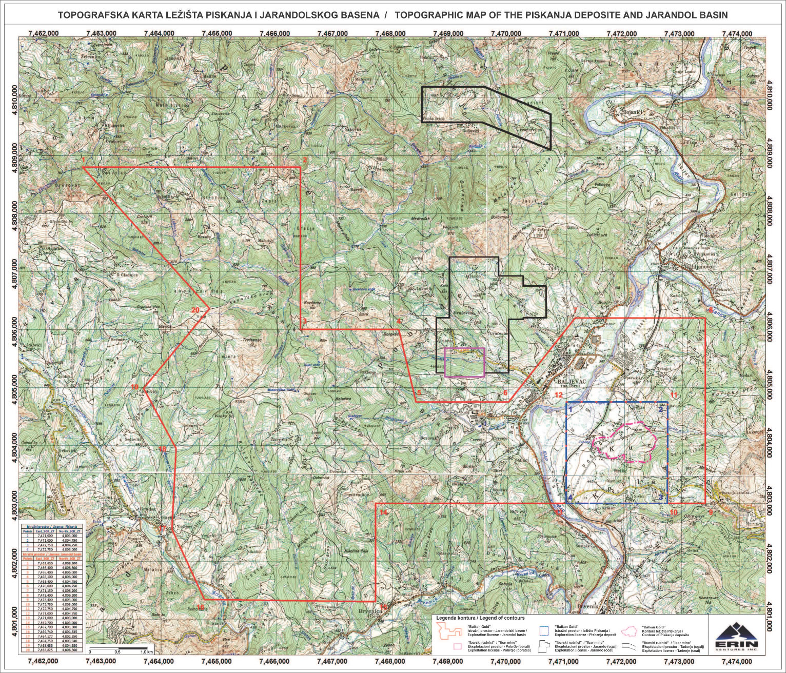
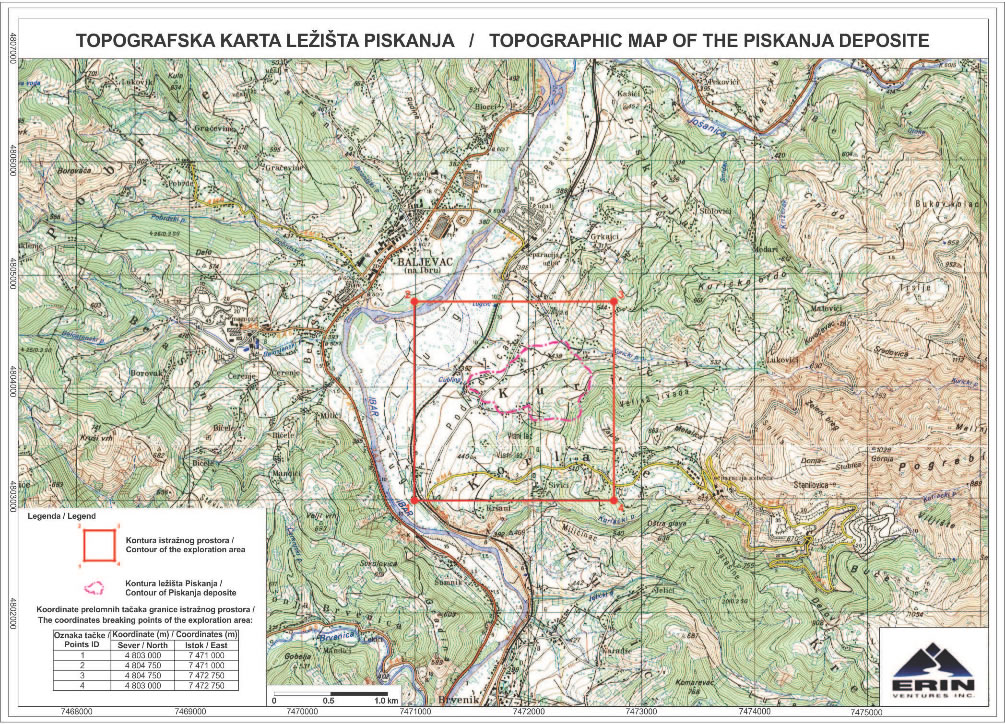
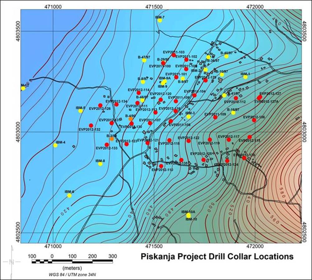
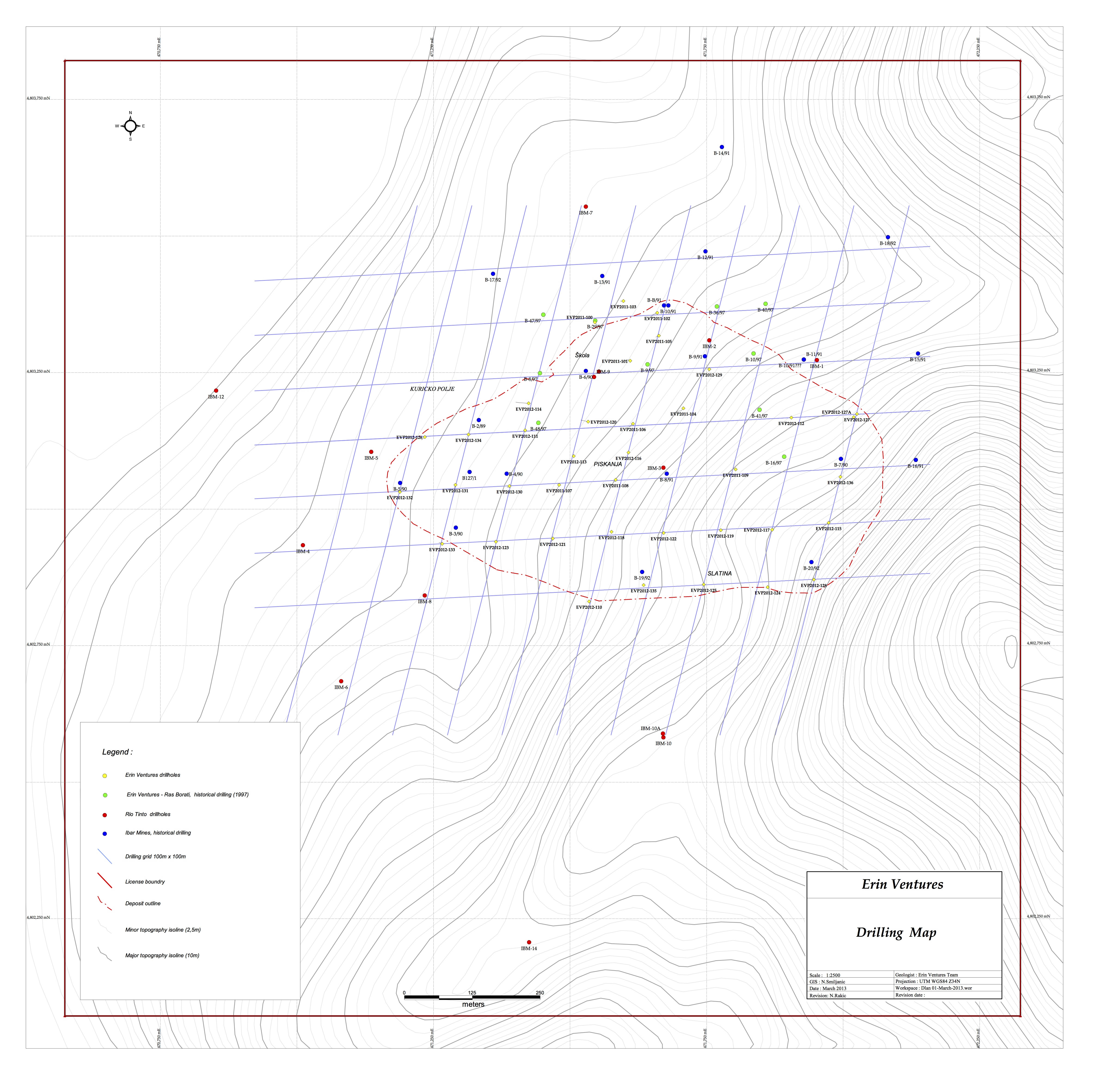
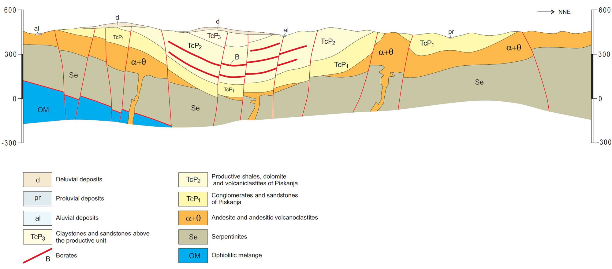
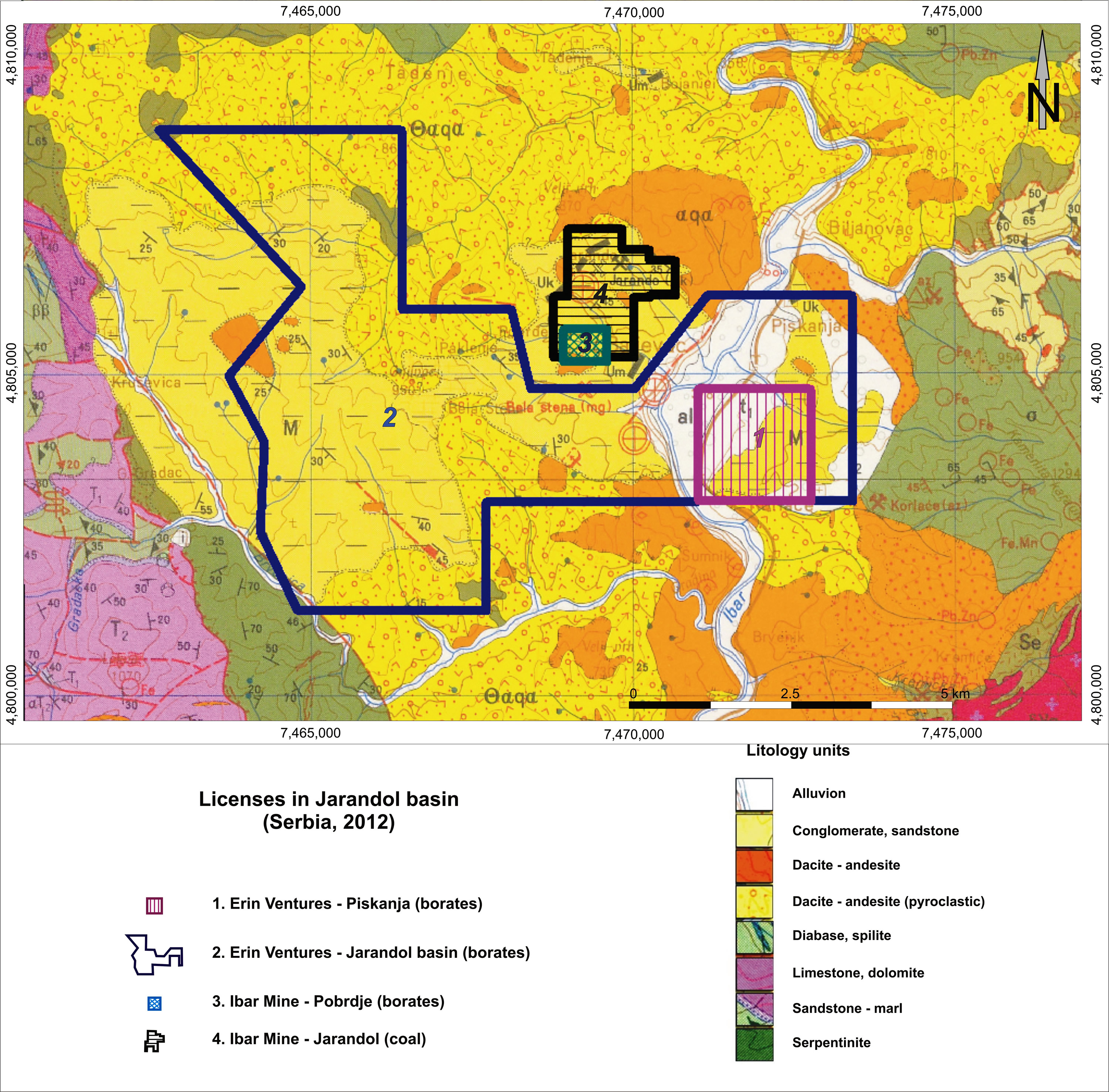
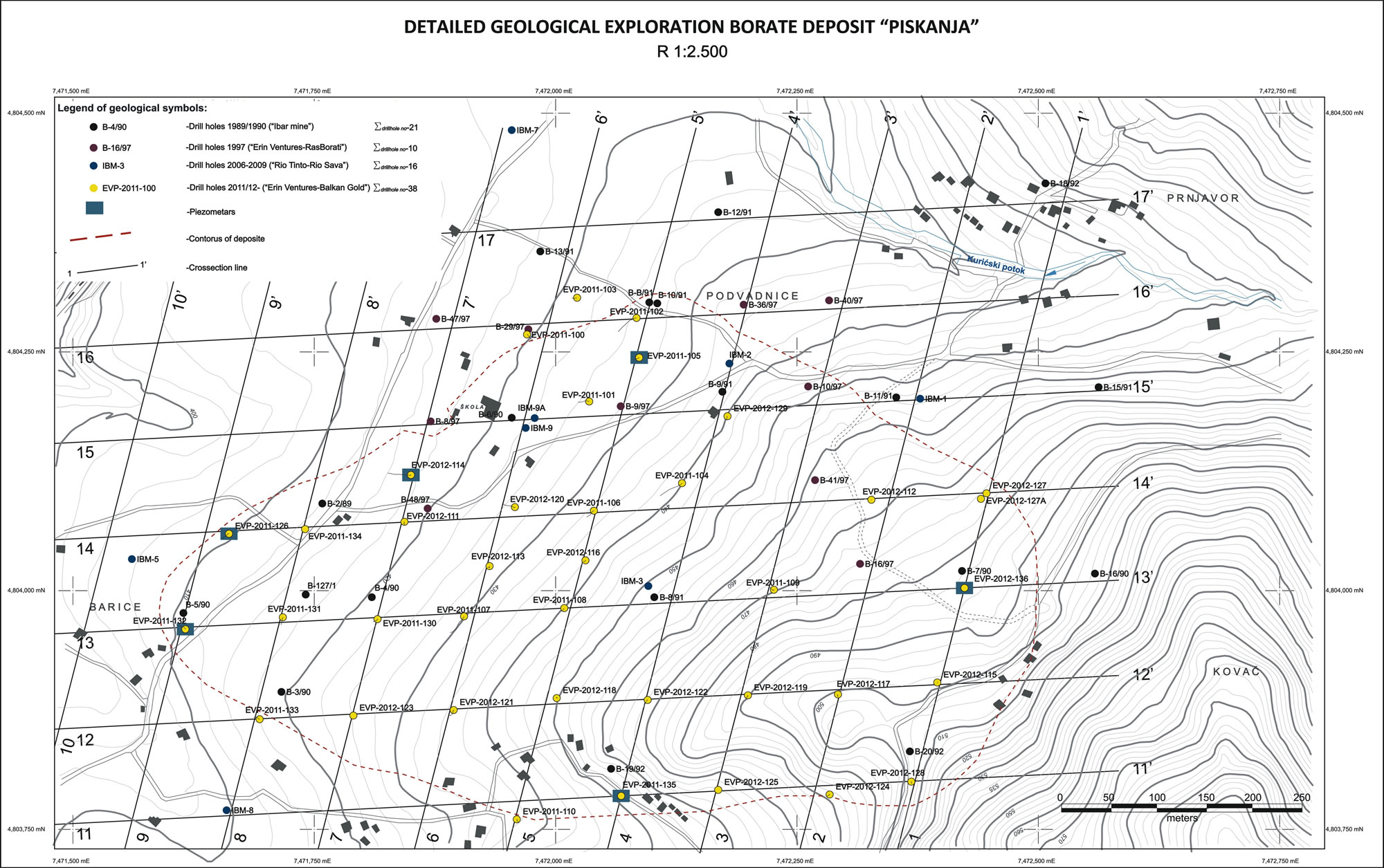
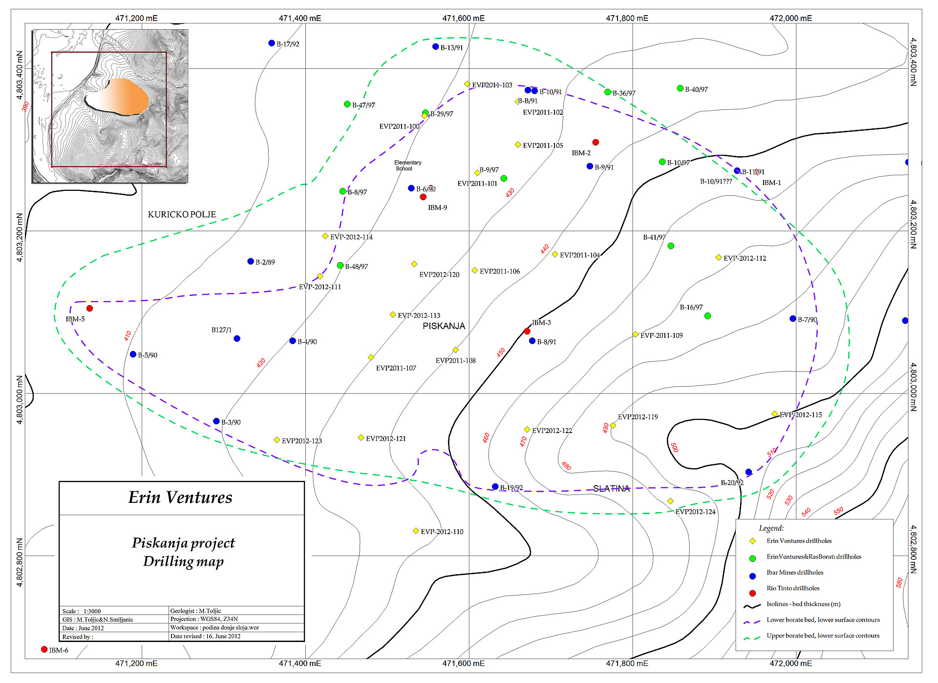
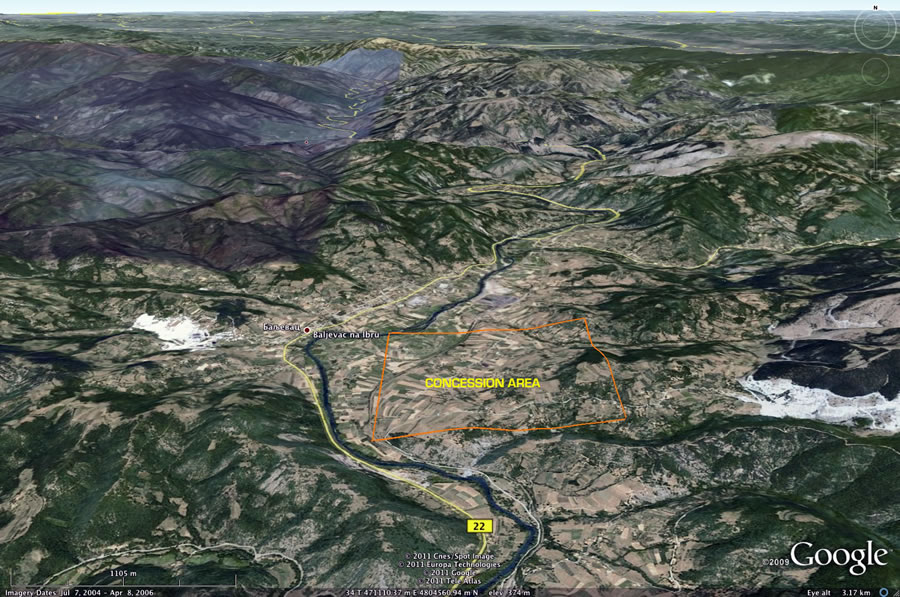
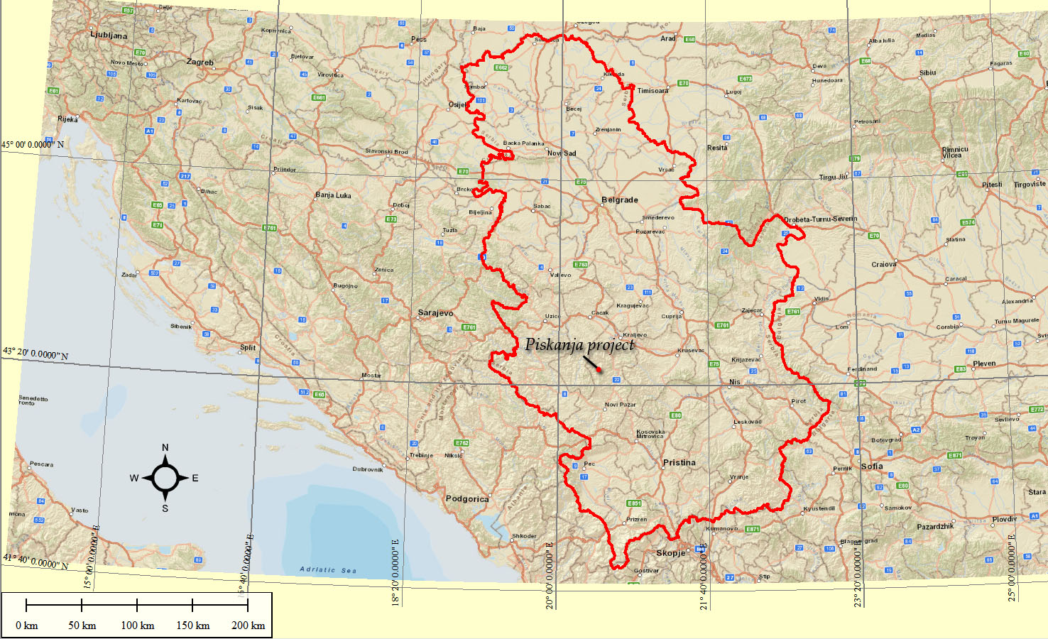
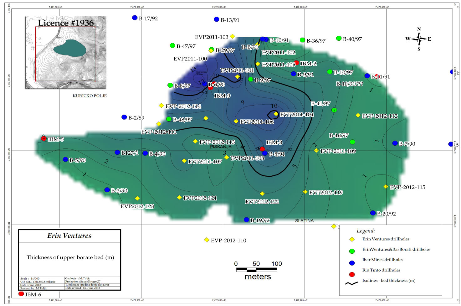
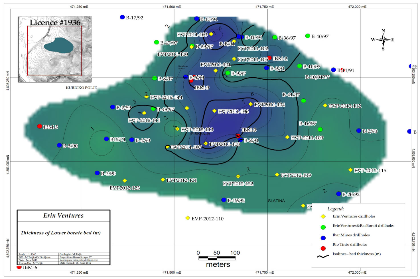
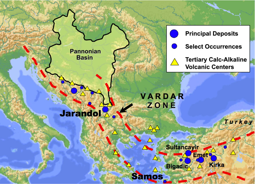
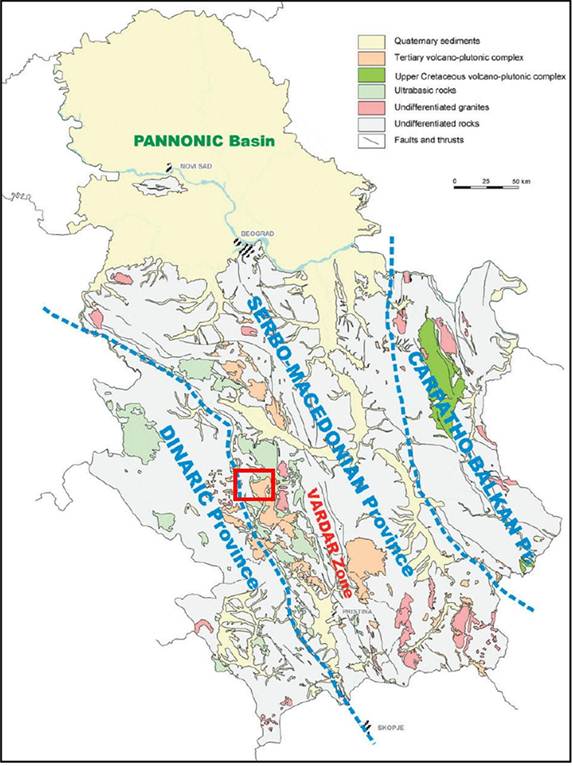
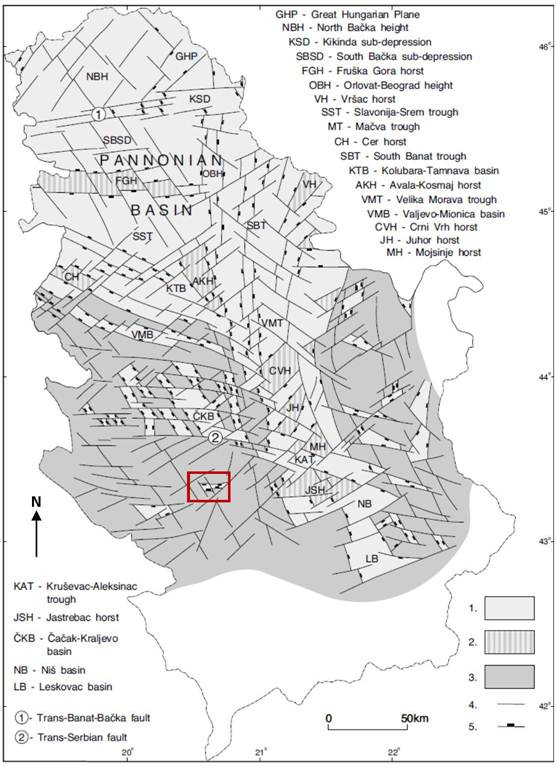
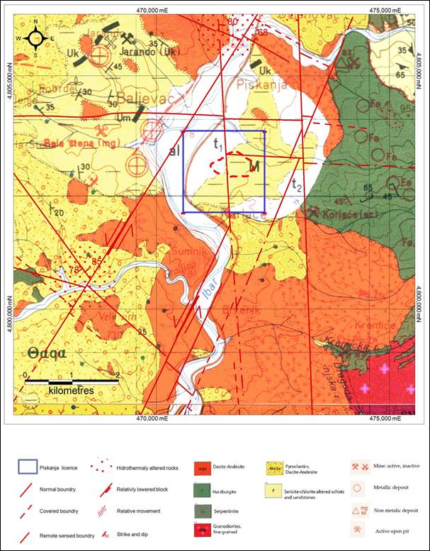
Erin Venture Property Maps
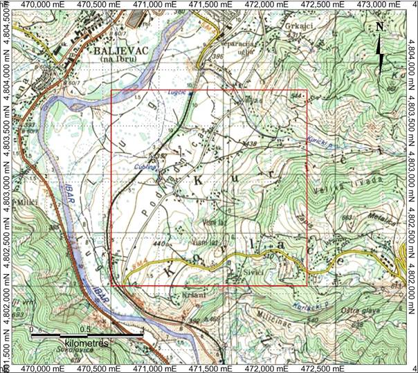
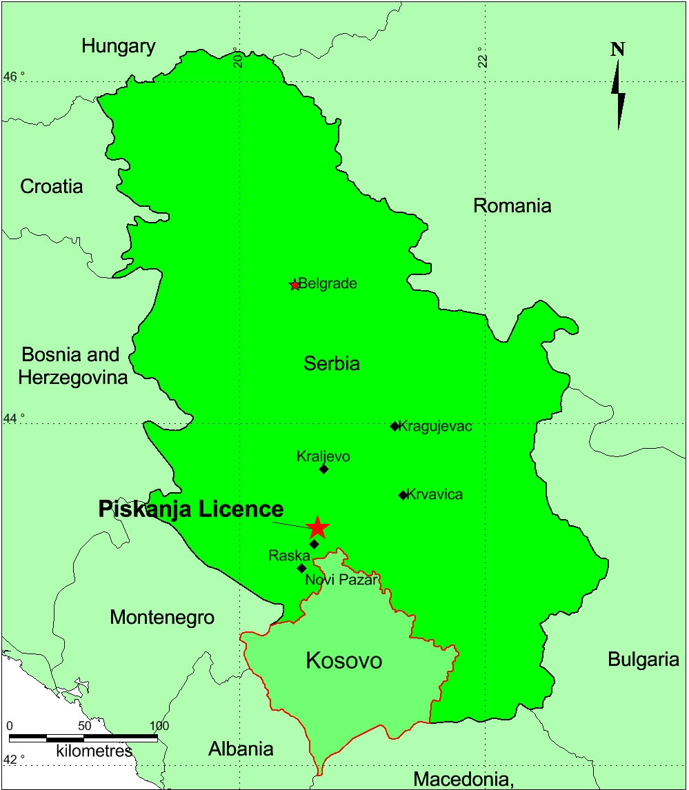
Piskanja, Serbia